Your drone’s camera captures the perfect sunset shot—until the warning flashes: “Entering Restricted Airspace.” One wrong move could trigger FAA enforcement, costing you thousands in fines. With over 2,000 no-fly zones across the United States and penalties reaching $32,666 per violation, understanding drone no fly areas isn’t just recommended—it’s your legal responsibility as a pilot. Whether you’re capturing neighborhood parks or professional real estate footage, this guide delivers exactly what you need to fly legally and safely.
This definitive resource breaks down every drone no fly area you must avoid, the real-time tools to identify them before takeoff, and the precise steps to verify your flight location complies with current regulations. No fluff, no guesswork—just actionable intelligence to keep you airborne and out of legal trouble.
Restricted Airspace Zones You Must Avoid
Permanent drone no fly areas surround sensitive locations where unauthorized flights pose serious security risks. The FAA bans all drone operations in these zones regardless of your pilot certification or flight purpose. Unlike temporary restrictions, these prohibitions never expire and cover military installations, nuclear facilities, and other critical infrastructure locations.
What Makes These Zones Different:
– 24/7 enforcement: Violations trigger immediate detection through radar and security systems
– Zero exceptions: No recreational or commercial waivers available
– Buffer zones: Restrictions often extend beyond facility boundaries into surrounding airspace
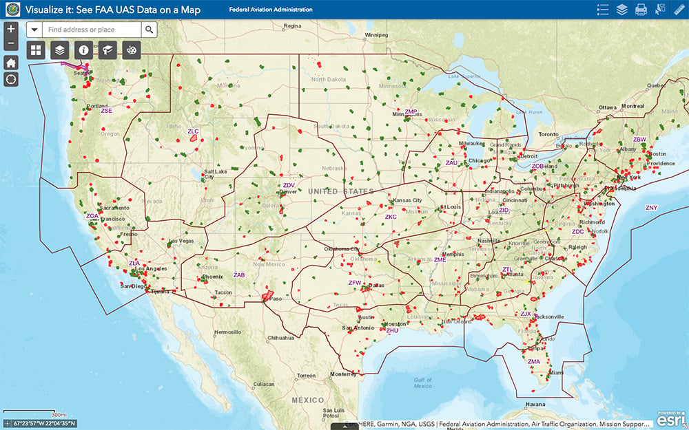
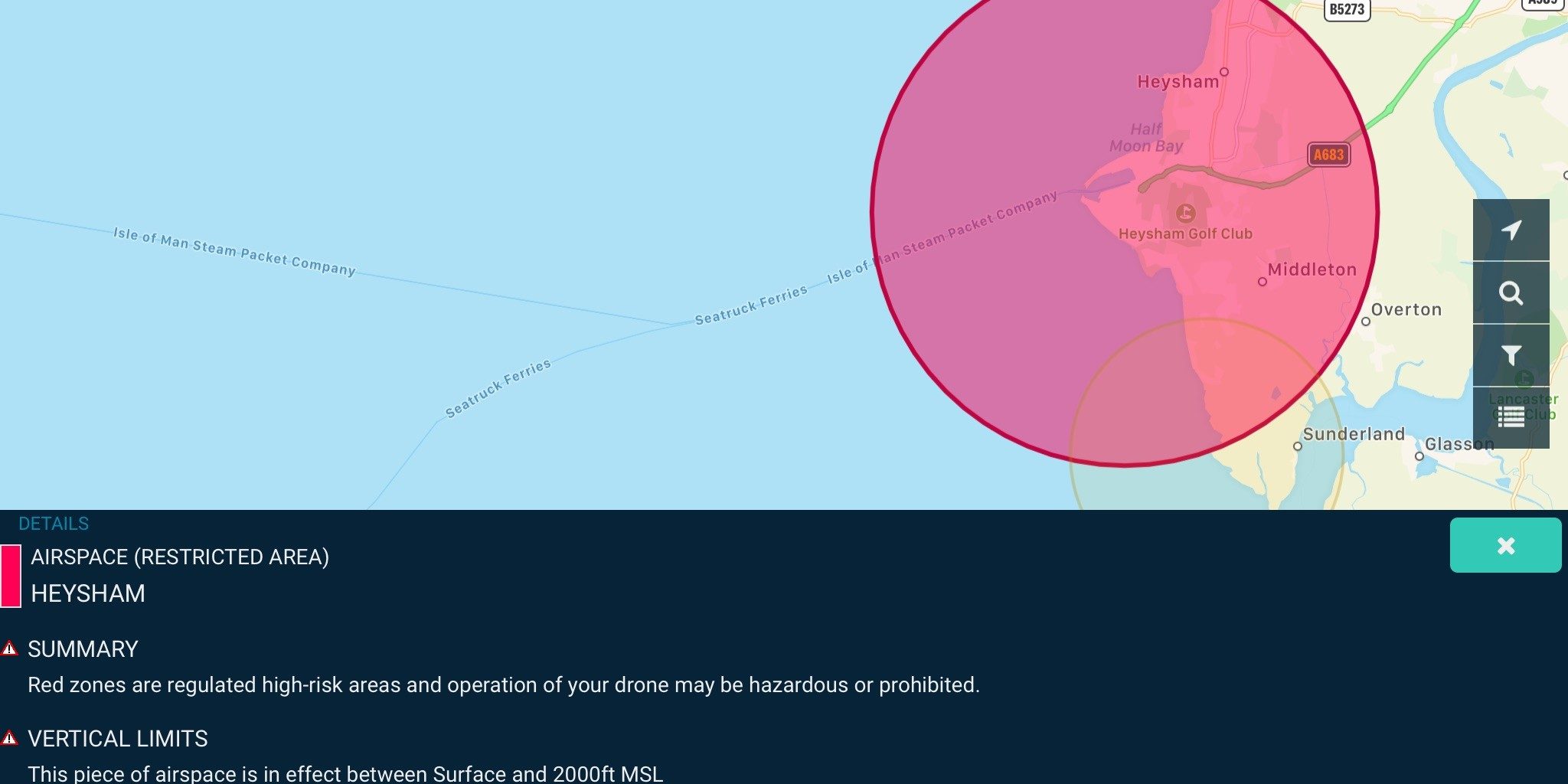
You’ll recognize these areas on maps as solid red polygons—never attempt flight within these zones even if you don’t see physical signage. Many drone manufacturers hardcode these locations into their geofencing systems, automatically preventing takeoff in restricted zones.
How Restricted Zones Appear on Your Drone App
When checking your flight planning app, permanent drone no fly areas display as semi-transparent red polygons covering the restricted location. These visual indicators represent 24/7 UAS flight prohibitions that override all other authorization systems. If your planned flight path overlaps with red zones, immediately select an alternative location—no exceptions exist for certified pilots or emergency operations.
Local Drone Restrictions That Catch Pilots Off Guard
State and local governments create drone no fly areas that specifically restrict takeoffs and landings—not airspace above. These local restrictions trip up even experienced pilots who assume airspace authorization covers ground operations.
Critical Distinctions Every Pilot Must Know:
– Ground-only restrictions: You might legally fly over a city park while being unable to launch from it
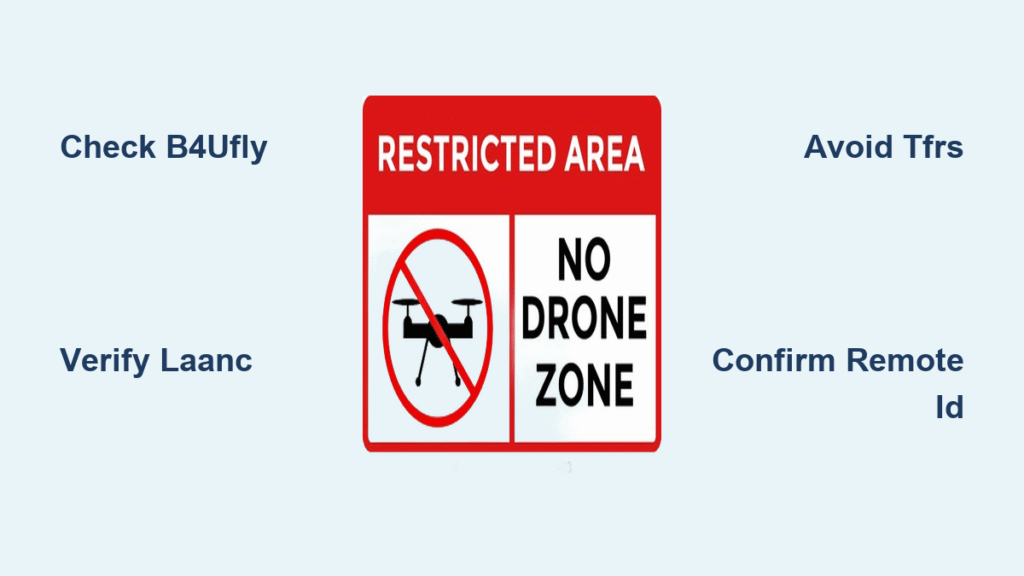
– Standardized signage: Official “No Drone Zone” signs indicate local takeoff/landing prohibitions
– Separate permissions required: Airspace authorization doesn’t grant property access rights
Before launching in urban areas, verify both airspace status through B4UFLY and ground restrictions through local ordinances. Many city parks now enforce no-launch policies despite having no airspace restrictions—violating these can still result in confiscation and fines.
Temporary Flight Restrictions That Change Daily
TFRs create time-sensitive drone no fly areas that often appear with little notice. These restrictions typically last hours to days but require immediate compliance from all drone operators.
Most Common TFR Triggers:
– Sports events: 3 nautical mile radius around stadiums during professional/collegiate games
– Emergency operations: Active wildfire zones, disaster response areas, and search/rescue missions
– Presidential movements: Temporary corridors along travel routes and destinations
– Space launches: Restricted zones around Cape Canaveral and other launch facilities
Each TFR specifies exact boundaries, altitude limits, effective times, and permitted operations. Check for new TFRs before every flight—these restrictions change daily and often appear overnight.
How to Verify TFR Status in 60 Seconds
Complete this essential pre-flight verification before every takeoff:
1. Open the B4UFLY app and enable location services
2. Check for purple zones indicating active TFRs within 5 miles
3. Tap each restriction for exact boundaries and duration
4. Cross-reference with LAANC status for controlled airspace authorization
5. Save screenshots of your clearance status for 30 days
Pro Tip: Set calendar alerts for recurring events near your regular flight locations—many TFRs follow predictable schedules like weekly sports events.
Recreational Pilot Compliance Essentials
Recreational flyers operate under specific exemption criteria through USC 44809. Failure to meet any requirement voids your legal protection, turning a hobby flight into a serious violation.
Must-Follow Checklist Before Takeoff:
– Confirm flight is purely for personal enjoyment (no commercial intent)
– Complete TRUST certification and carry proof of completion
– Register drones weighing 250g-55 lbs with the FAA
– Maintain visual line of sight (no FPV-only flights without visual observer)
– Never exceed 400 feet above ground level
– Yield right of way to all manned aircraft
Critical Mistake: Assuming you can fly near airports because you’re recreational. All drone no fly areas apply equally to recreational and commercial pilots—LAANC authorization remains mandatory for controlled airspace.
Commercial Operation Requirements That Matter

Part 107 pilots face stricter drone no fly area compliance with additional documentation requirements. Your business depends on understanding these critical distinctions.
Pre-Flight Documentation Checklist:
– Valid remote pilot certificate
– Aircraft registration visible on drone
– Remote ID compliance (except in FRIAs)
– LAANC authorization reference number
– Weather assessment meeting visibility requirements
– Flight log with purpose, time, and location
Authorization Differences You Must Know:
– LAANC provides instant authorization for routine operations
– Certificate of Waiver/Authorization (COA) required for complex operations near critical infrastructure
– COA applications take 60-90 days—plan major projects accordingly
Commercial pilots often need specific rather than area authorizations, requiring precise flight path documentation that recreational flyers don’t need.
Enforcement Tactics That Will Find You
The FAA employs multiple methods to detect drone no fly area violations, making侥幸 flying a dangerous gamble.
How You’re Caught:
– Public reports through FAA online system (most common detection method)
– Airport radar tracking unauthorized flights
– Security camera footage from protected facilities
– Local law enforcement coordination during events
Penalty Escalation Path:
– First violation: Warning letter and mandatory training
– Second offense: Up to $1,437 civil penalty
– Serious violations: $32,666 per incident maximum
– Reckless endangerment: Criminal referral and certificate suspension
That stadium TFR violation during last Sunday’s game? The FAA typically investigates within 48 hours, contacting registered drone owners with evidence from multiple sources.
Critical Infrastructure Zones You Can’t Risk
Beyond airports, drone no fly areas protect essential facilities where unauthorized flights could disrupt public safety.
Protected Locations Requiring Extra Caution:
– Nuclear facilities and power plants (permanent 5-mile radius restrictions)
– Water treatment facilities and electrical substations
– Transportation hubs (ports, major train stations)
– Federal buildings and courthouses
Public Venue Restrictions During Events:
– Stadiums seating 30,000+ (3 nautical mile radius during events)
– Music festivals with 100,000+ attendees
– Political conventions and major public celebrations
Many drone operators mistakenly believe infrastructure zones only restrict flights directly over facilities—restrictions often extend significantly into surrounding airspace.
Professional Verification Tools That Prevent Violations
Relying on memory or outdated information guarantees problems. These verification methods keep you compliant with current drone no fly areas.
Essential Digital Toolkit:
– B4UFLY app: Primary FAA resource for real-time restriction checks
– UAS Facility Maps: Planning reference for controlled airspace operations
– LAANC system: Automated authorization for controlled airspace
– NOTAM publications: Official notices of temporary restrictions
Pro Verification Protocol:
1. Check B4UFLY the night before planned flights
2. Recheck 30 minutes before takeoff (TFRs change frequently)
3. Cross-reference with local ordinances for ground restrictions
4. Save screenshots of clearance status with flight logs
5. Verify Remote ID functionality for commercial operations
Remember: UAS Facility Maps don’t provide real-time updates—always confirm with B4UFLY before flight.
Final Pre-Flight Compliance Checklist
Before every drone flight, complete this verification sequence:
- B4UFLY check with location centered on your planned takeoff point
- LAANC authorization obtained if in yellow or purple zones
- Weather assessment meeting visibility requirements
- Ground permission secured for local no drone zones
- Emergency contacts programmed in phone and shared with someone
Staying compliant with drone no fly areas requires constant vigilance but becomes routine with proper verification habits. Your drone registration links directly to your personal information—violations will find you. Make pre-flight airspace checks as automatic as charging your batteries, and you’ll enjoy worry-free flying while keeping our national airspace safe. The most experienced pilots know: when it comes to restricted zones, there’s no such thing as “just a quick flight.”